
This Photo Set presents 17 still photographs taken by a local community member who has been trained by KHRG to monitor human rights conditions.[1] The photos were all taken in March 2012 at the Toh Boh Dam construction site in Tantabin Township within locally-defined Toungoo District.[2] According to the community member who took these photos, more than 100 households have been relocated from the area now occupied by the dam construction site, where construction is ongoing. For additional information on the Toh Boh dam, see “Toungoo Interview: Saw H---, April 2011," published by KHRG in September 2012.
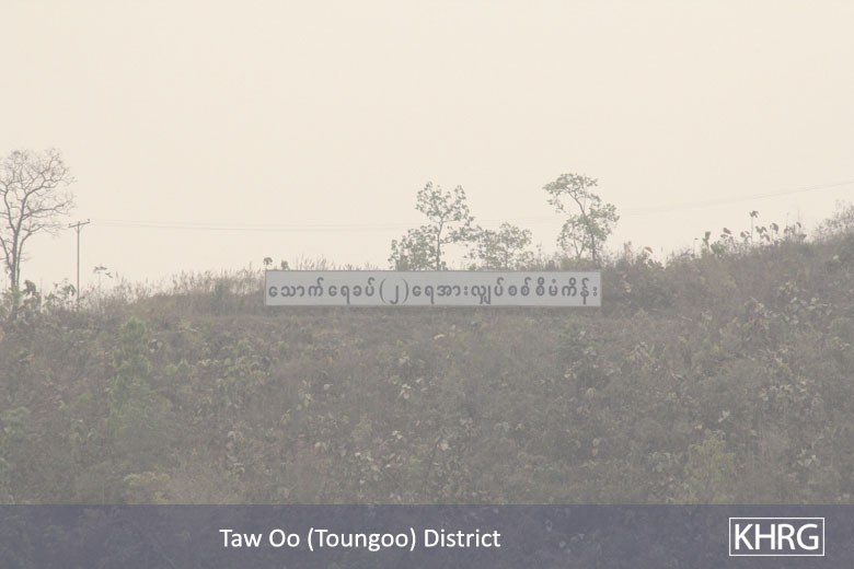
Photo Set | Tantabin Township, Toungoo District (March 2012)
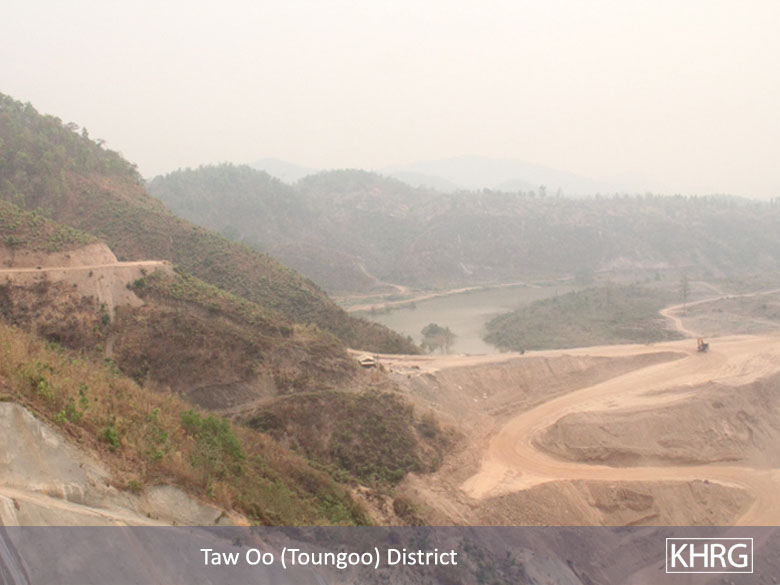
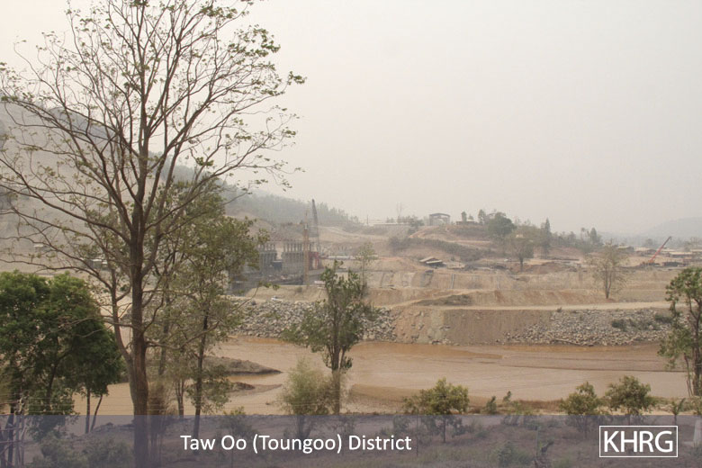
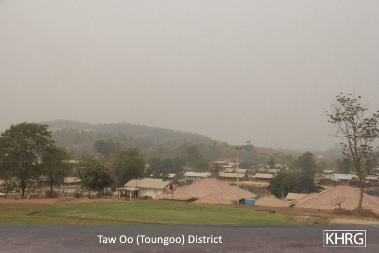
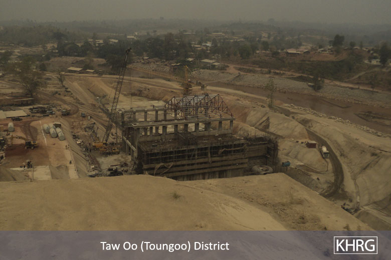
This photo was taken in March 2012, and shows the Day Loh River Valley in Tantabin Township, Toungoo District where the dam is being constructed.[3] Vechicle access roads in the vicinity of the dam site and large swathes of deforested land are also clearly visible. [Photo: KHRG]
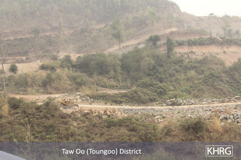


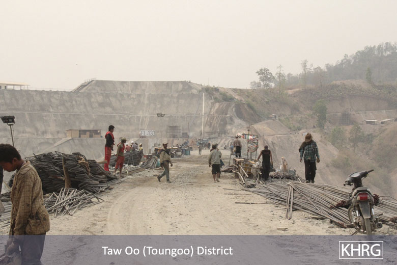
The above left photo shows vehicle roads approaching the Toh Boh Dam construction site, while the photo above right shows a bulldozer on another road. While 100 households were relocated from the dam site itself, road-building in the surrounding area has the potential to destroy or limit villagers' access to additional cultivable land. [Photos: KHRG]
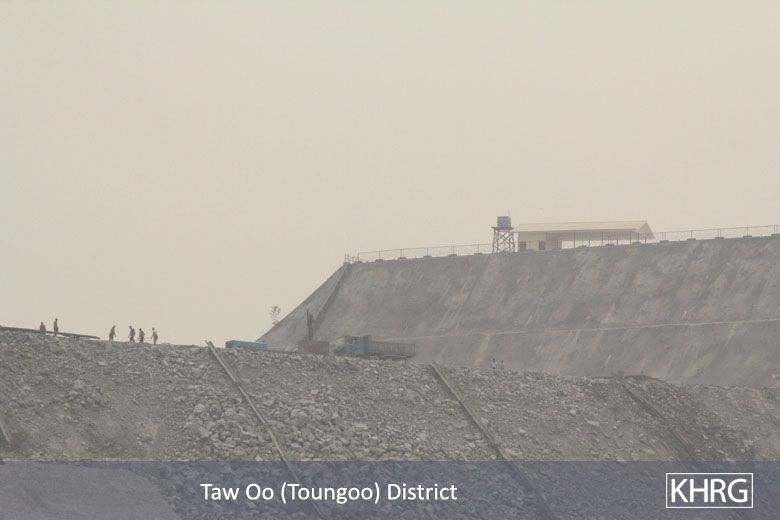


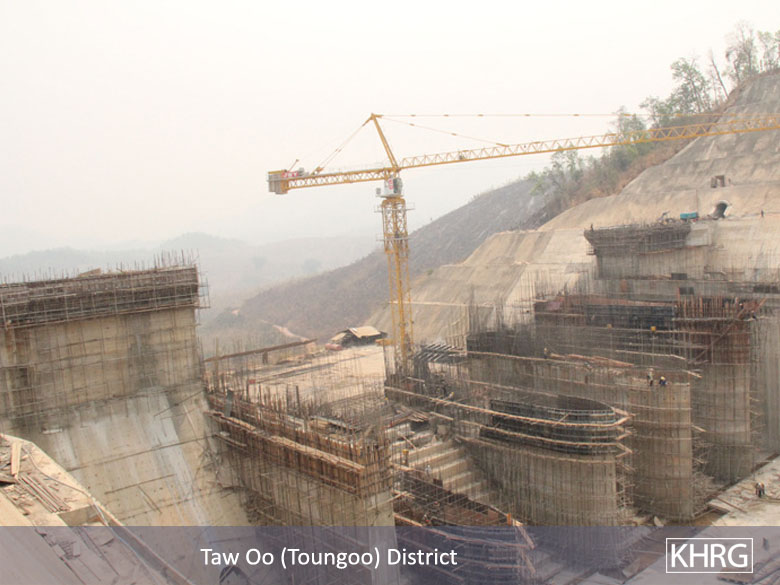
The above left photo shows people and vehicles on top of the Toh Boh Dam under construction. In the above right photo, a sign in black reads: "Thauk Yay Khat (2) hydropower electricity project." [Photos: KHRG]


The photos above show electricity pylons on a different side view of the Toh Boh Dam under construction. In the above right photo, the sign in red reads: "Tunnel for diverting water out." [4][Photos: KHRG]


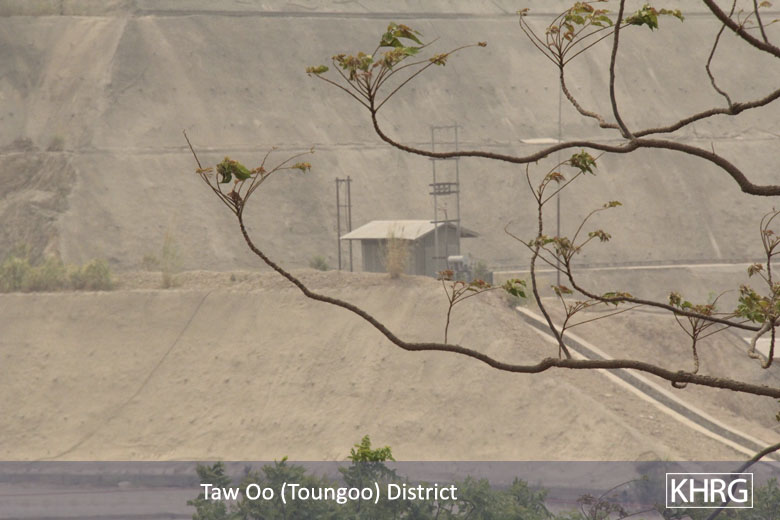
The two photos above show housing areas for construction workers near the Toh Boh Dam construction site. [Photos: KHRG]
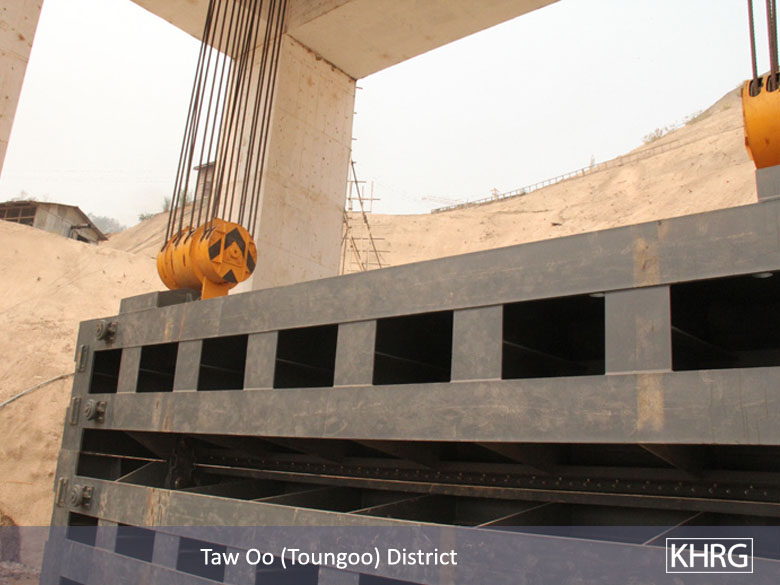


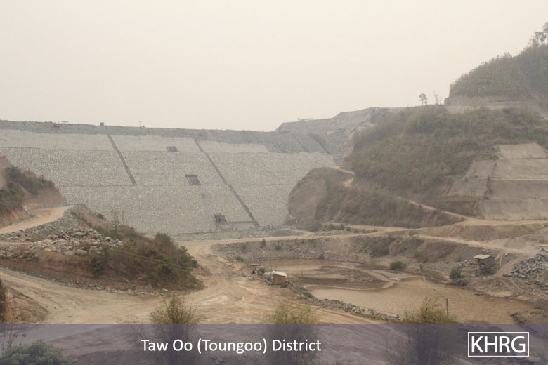
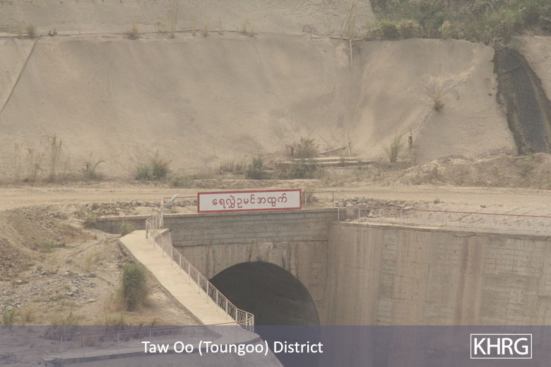
The first photo shows the steel door that will control the water flow from the Day Loh River. The second photo shows the spillway control section, designed to regulate the amount of water flow; when the water reaches a certain elevation, the spillway control section will reduce the amount of water flow from the upper dam. According to the community member who took these photos, the surrounding agricultural land belongs to villagers from 10 villages, which includes durian, mangosteen, cardamom and betelnut [5] plantations, all of which would be flooded if the dam becomes operational.[6] [Photos: KHRG]
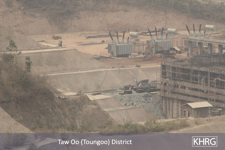


The photos above show two different views of the powerhouse that will produce electricity from the dam. The yellow pipe beneath the powerhouse allows water to enter and connect to the machine that produces hydropower. [Photos: KHRG]
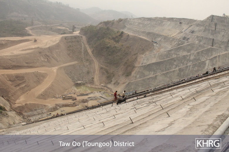
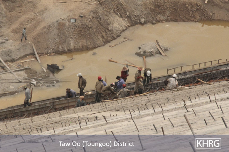


The photos above were taken in March 2012 in the Day Loh River Valley. The photos show construction workers building cement terraces, reinforced with bamboo poles, which together will contain the water once the dam becomes operational. In the background, features characteristic of excavation for unknown purposes are present.[7] [Photos: KHRG]
Footnotes:
[1] KHRG trains villagers in eastern Burma to document individual human rights abuses using a standardised reporting format; conduct interviews with other villagers; write general updates on the situation in areas with which they are familiar; and take photographs and videos as evidence of abuse.
[2] According to government designations, the dam site is in Tantabin Township, Eastern Bago Region. "Toh Boh" is the Karen language name for the dam site and adjacent village, which is also known as "Tun Boh" in Burmese language.
[3] The river is referred to as "Day Loh" in the Karen language and "Thauk Yay Kah" in Burmese.
[4] According to a report from Free Burma Rangers (FBR) in December 2011, "construction of the Toh Boh Dam has displaced one village and will affect 12 villages if completed. Asia World Company began building this hydropower dam in 2004 along the Day Loh River near Toh Boh Village, causing all the people in the village to move away. When the project is completed, flooding will affect people in 12 additional villages: Pa Leh Wa, Lay Mine, Mine Na Seh, Swa Lo, Naw Ka Maw, Ngway Taung, Toe Thaw, Tha Hpan Chaung, Tha Ye Ba, Joh Pin Seit, Kyaute Pa Sar and Theh Pyu. Mine Na She, Swa Lo and Toh Boh will likely flood, and people's livelihoods in the other ten villages will be heavily affected. In this area people use this river as their primary transportation route." See: "Burma Army Shoots Villager in Pa'an District and Continues Construction on Toh Boh Dam in Toungoo District," Karen State, Free Burma Rangers, December 22nd 2011.
[5] In Burmese, "betelnut" and "betel leaf" are referred to as "konywet" and "konthih," as if they are from the same plant. The Burmese names are also commonly used by Karen language speakers. "Betelnut" is the seed from an Areca Palm tree, areca catechu; "Betel leaf" is the leaf of the Piper betel vine, belonging to the piperaceae family. See "Attacks on cardamom plantations, detention and forced labour in Toungoo District," KHRG, May 2010.
[6] FBR local community leaders estimated that over 5,000 acres of land will be flooded, including lemon, paddy rice, banana and betelnut fields. Three Tatmadaw camps – Chay Soe, Pa Na Wah Soe and Yaw Mu Kee – surround the dam. Soldiers from Tatmadaw Infantry Battalion (IB) #39, under the Southern Command, are in each camp; see "Burma Army Shoots Villager in Pa'an District and Continues Construction on Toh Boh Dam in Toungoo District, Karen State," Free Burma Rangers, December 22nd 2011.
[7] In the interview received by KHRG along with these photos, Saw H--- describes the likelihood of mining operations occurring simultaneously with the dam construction. Additionally, the top right photo resembles previous gold-mining operations along the rivers in Dweh Loh Township, Papun District; see "Papun Situation Update: Dweh Loh Township, May 2011," KHRG, September 2011.


