This Photo Set illustrates the ongoing militarisation, land confiscation, displacement and village agency documented between December 2016 and January 2018 across four districts in southeast Myanmar.
- Despite the 2015 ceasefire between the KNU and the Burma/Myanmar government, the Tatmadaw has continued military activities throughout Southeast Myanmar. In Toungoo District, the Tatmadaw has held a Company Commander training every four months at Bu Yint Naung Army Camp. In Toungoo, Nyaunglebin, and Dooplaya Districts, the Tatmadaw frequently transported rations, ammunitions and weapons to army camps. This Photo Set also shows evidence of Tatmadaw soldiers trespassing into KNU demarcated areas.
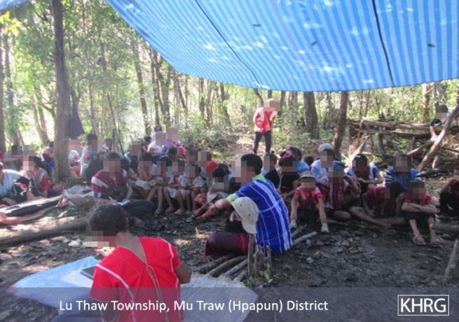
- Internally displaced people (IDPs) employed different agency strategies to protest their condition. On May 15th 2017, 615 IDPs protested against the presence of Tatmadaw army camps in Pla Hkoh village tract, Hpapun District. On October 14th 2017, 86 people in Ler Mu Plaw village tract, Hpapun District held a prayer service asking to return to their homes.
- Both large- and small-scale instances of land confiscation occurred in this period. In Toungoo District, 2,108 acres of land were confiscated by Tatmadaw Bu Yint Naung Army Camp. This land was seized from local villagers for military training purposes. Tatmadaw Light Infantry Battalion (LIB) #340 confiscated land from local villagers to extract rent from community members in Meh Klaw village tract, Bu Tho Township, Hpapun District. In Dooplaya District, the Border Guard Force (BGF) Battalion #1012 confiscated 173.8 acres of land from a local villager in Kyainseikgyi Township.
Photo Set | Toungoo, Hpapun, Nyaunglebin, Thaton and Dooplaya districts (December 2016 – January 2018)
The following photos were taken by a community member in Toungoo, Hpapun, Nyaunglebin and Dooplaya districts who has been trained by KHRG to monitor human rights conditions. They are presented below, censored where necessary for security purposes.[1] The 27 photos below were received along with other information from Toungoo, Hpapun, Nyaunglebin and Dooplaya districts.[2]
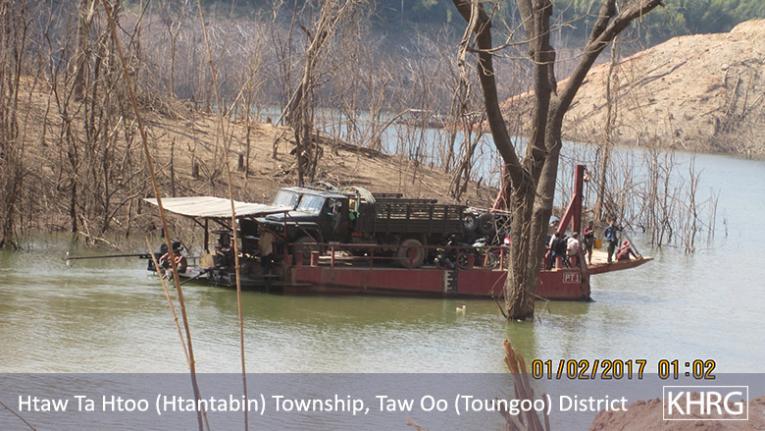
These photos were taken between February 1st 2017 and February 22nd 2017, at P’lae Wa area, Htantabin Township, Toungoo District. The photo on the left shows a military truck full of rations being transported across a river. The photo on the right shows Tatmadaw military trucks transporting rations to Kler La Army camp. According to a KHRG community member, local villagers had to wait for an hour to use the road while the Tatmadaw was transporting rations. Villagers were also delayed because the Tatmadaw was using the boat to cross the river. [Photos: KHRG]
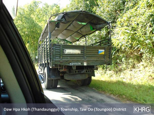
This photo was taken on October 28th 2017 in B--- village, Thandaunggyi Township, Toungoo District. It shows Tatmadaw soldiers returning from a Tatmadaw army camp and other frontline camps after transporting rations. [Photo: KHRG]
This photo was taken on July 27th 2017, near Thandaunggyi Town, Thandaunggyi Township, Toungoo District. It shows the Support Unit #930 transporting rations, ammunition and weapons to Thandaunggyi Bu Yint Naung Army Camp and frontline army camps. The truck was covered in grain tarpaulin. [Photo: KHRG]
This photo was taken on July 20th 2017 in C--- village, Kaw Thay Der village tract, Htantabin Township, Toungoo District. The photo shows a troop rotation. Tatmadaw Military Operations Command (MOC) #13, based in A--- village, is heading to Bu Hsa Hkee area. [Photo: KHRG]
This photo was taken on December 9th 2016 in Lay Maing area, Htantabin Township, Toungoo District. It shows Tatmadaw transporting horses and military equipment in 23 trucks. The horses are used to transport rations to the frontline army camps in the east of Htantabin Township. According to the KHRG community member who took this photo, there are less army camps in the area since the 2015 ceasefire. Yet, many of them remain and cause disruptions to the local community. [Photo: KHRG]
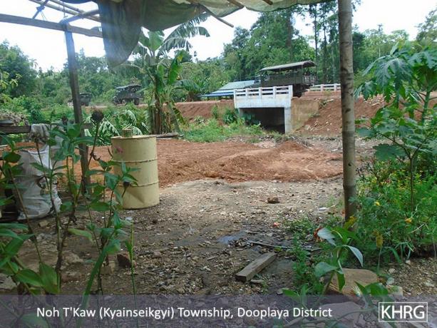
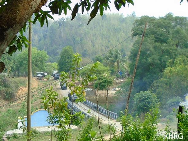
This photo was taken on May 12th 2017, in D--- village, T’Khaw Loo area, Noh Taw Pla village tract, Kyainseikgyi Township, Dooplaya District. The photo shows Tatmadaw military trucks from Light Infantry Battalion #299. They are returning from a ration delivery to local army camps. [Photo: KHRG]
This photo was taken on December 1st 2017, on W--- vehicle road in X--- area, Htantabin Township, Toungoo District. It shows a Tatmadaw bulldozer upgrading a local military vehicle road. This road is used to transport rations to Th’Aye Hta Army Camp. According to a KHRG researcher, the Tatmadaw trespassed into KNU demarcated areas while constructing the road. Because this area was heavily mined, three Tatmadaw soldiers were injured. [Photo: local villager]
These photos were taken on August 2nd 2017, in E--- village, Shauk Pin Chaung village tract, Thandaunggyi Township, Toungoo District. They show artillery shells that have been fired by Tatmadaw forces during a Company Commander training that happened between July 12th 2017 and July 15th 2017. During this exercise, plantations in E---, F---, and G--- villages in Shauk Pin Chaung village tract were damaged because of the shelling. After the Tatmadaw completed their training, they did not clear this area. Many shells and remains of exploded devices were left on the ground. Local villagers are worried that unexploded devices might be left behind on their land. They do not feel safe working on their plantations. [Photos: KHRG]
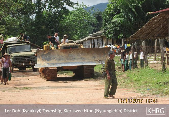
These photos were taken on November 17th 2017 in H--- village, Muh Theh village tract, Kyaukkyi Township, Nyaunglebin District. They show a Tatmadaw bulldozer coming through H--- village. The Tatmadaw plans to upgrade a military road from H--- to I--- villages. The Tatmadaw repairs this road annually to ensure that it can be used for military purposes, and to transport rations. The Tatmadaw also plans to build a road across the border of Nyaunglebin and Hpapun Districts.
Community members from H--- village feel that, despite the 2015 ceasefire, “Tatmadaw is heavily present in civilians’ areas by doing troop rotations, transporting rations, trespassing into KNU delimited areas and improving the quality of its roads”. Because of this, villagers do not feel safe when travelling. The local community urges the Tatmadaw to withdraw from their army camps. [Photos: KHRG]
These photos were taken on December 15th 2017 at P’lae Wa place, Htantabin Township, Toungoo District. The photo shows Tatmadaw transporting military trucks on a ship. They are crossing the river on their way to Kler La and Kaw Thay Der army camps to transport rations. The Tatmadaw is also sending more soldiers to these camps. Local community members believe that the Tatmadaw is preparing for the possibility of renewed fighting. [Photos: KHRG]
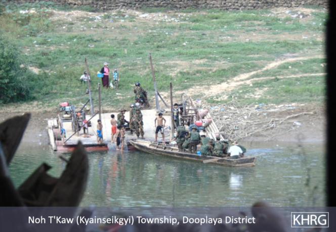
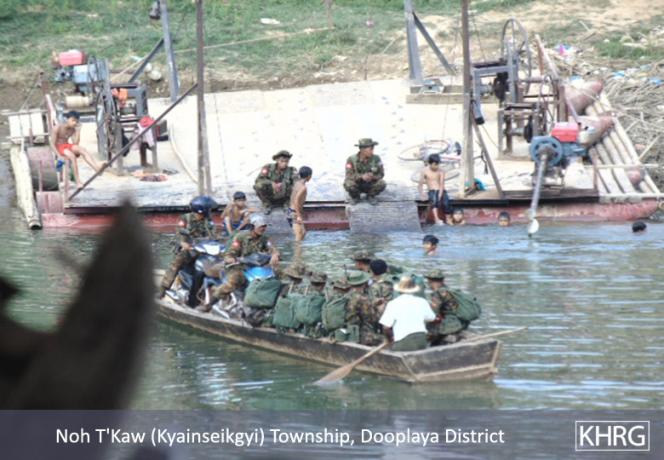
These photos were taken on January 28th 2018, on the banks of Z’mi Chaung river, in Kyainseikgyi Township, Dooplaya District. The photos show more than 20 soldiers from Infantry Battalion (IB) #32 crossing a river by boat. IB #32 is led by Commander Major Lay Naing. They are returning from Win Yin Township after an operation to stop the Mone Army from conducting a military parade during the celebration of welcoming the NCA. This operation happened before the Mone Army was about to sign the NCA, on February 13th 2018. [Photos: KHRG]
These photos were taken on May 15th 2017, in Pla Hkoh village tract, Lu Thaw Township, Hpapun District. They show IDPs holding a protest to urge the Tatmadaw to withdraw from their army camps. Approximately 615 IDPs participated in this protest. They want to return to their homes and resume cultivating their farms.
The photo on the lower right shows a banner written in S’Gaw Karen, outlining the main objectives of the protest: “Villagers in Pla Hkoh village tract are holding a protest to urge the Tatmadaw to withdraw from our original villages and working areas.”
They also listed the main objectives of their protest:
1) We don’t want to be forcibly ruled by other ethnic [groups]
2) Tatmadaw camps based in our area should withdraw by the end of 2017
3) We want to work freely and peacefully for our livelihoods.
4) We want to be ruled by our own ethnic leaders.
Despite this protest, Tatmadaw continued to reinforce their military presence in Lu Thaw Township. [Photos: KHRG]
This photo was taken on September 28th 2017, in J--- village, Ler Muh Plaw village tract, Lu Thaw Township, Hpapun District. The photo shows the students from J--- village digging a bomb shelter to protect themselves from being hit by bullets or shrapnel from shelling. They are worried that clashes will break out again between Tatmadaw and Karen armed groups. The local community leaders asked students to prepare a bomb shelter. Even though the Nationwide Ceasefire (NCA) was signed, the local community are worried about an outbreak of violence because the Tatmadaw is bolst ering its military presence in the area. [Photo: KHRG]
These photos were taken on May 7th 2017, in M--- village, Zeyarthiri Township, Nay Pyi Taw Union Territory. The photo on the left shows Tatmadaw Infantry Battalion (IB) #122, Zeyarthiri Township, Ottara District and Tatmadaw Operation Commander (G3) arbitrarily relocating villagers from M--- village. They are forcing villagers to dismantle their houses where they have been living for three decades. Despite the fact that this community has been here for so long, the Tatmadaw claimed that villagers trespassed on this land.
The photo on the right shows Tatmadaw trucks transporting wood and other materials from the villagers’ dismantled houses. They are moving housing materials to Popa Kone, as part of an operation to forcibly relocate households from M--- village. Prior to this relocation, the Tatmadaw held a consultation with local community members. They gave villagers very little time to prepare. As a result, community members lost their lands and the plantations that they have been working on for decades. [Photos: KHRG]
This photo was taken on August 14th 2016 in N--- village, Shauk Pin Chaung village tract, Thandaunggyi Township, Toungoo District. The photo shows a signpost set up on August 10th 2016 by Tatmadaw Major Kyaw Kyaw Lwin. He is a military school commander from Bu Yint Naung army camp. The signpost states, in Burmese language, that: ‘These 1,521 acres of land are used as a Military Training Ground and no one is allowed to trespass. The Ministry of Home Affairs Order #300/2-2 of May 30th 2016 and Order #300/2-5 of March 20th 2016 recognises these 1,521 acres of land as land owned by the Tatmadaw Military Training School (Bu Yint Naung). This area is dangerous as military exercises and shooting practices are conducted here every day.’ According to local villagers interviewed by KHRG community members, Major Kyaw Kyaw Lwin did not provide any notice before he set up the signpost. Additionally, the Tatmadaw conducts trainings every three to four months. [Photo: KHRG]
This photo was taken on August 31st 2016 in O--- village, Htantabin Township, Toungoo District. The photo shows a signpost set up next to a local farm. The signpost states, in Burmese language: ‘These 587 acres of land are a Military Training Ground and no one is allowed to trespass. The Ministry of Forestry Order #096/211 of February 24th 2011 transferred these 587 acres of reserved forest to Tatmadaw. It recognises this land is owned by the Tatmadaw Military Training School (Bu Yint Naung). This area is dangerous as military exercises and shooting practices are conducted here every day.’ Although the Tatmadaw and Burma/Myanmar Ministry of Environmental Conservation and Forestry claimed ownership of this land, the photo shows the farm owned by local villagers, that was passed down to them from their great-grandparents. According to KHRG community members, the Tatmadaw arbitrarily confiscated this land from villagers from O---. They claimed that it is land owned by the Tatmadaw, and that it had previously been reserved forest administered by the Burma/Myanmar Ministry of Forest. [Photo: KHRG]
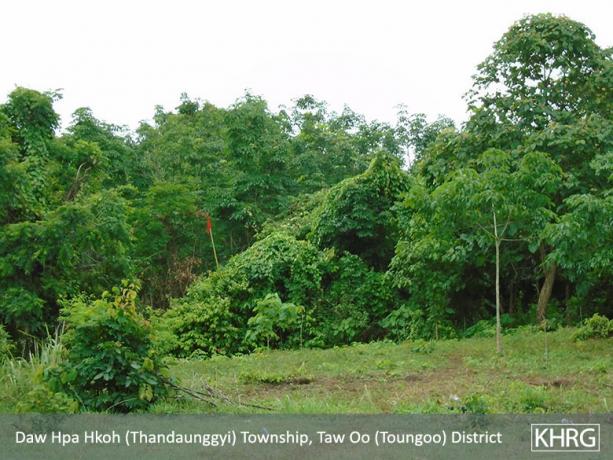
These photos were taken on July 21st 2017, in N--- village, Shauk Pin Chanug village tract, Thandaunggyi Township, Toungoo District. The photo on the right shows a rubber plantation owned by local community members. The red sign was put up by Tatmadaw soldiers during a military training.
The photo on the left shows rubber trees that were cut down by Tatmadaw soldiers prior to their company commander training on July 12th 2017. The training further damaged the villager’s rubber plantation. When company commanders were practicing their shooting skills, they fired at some of the remaining rubber trees. The owner reported to KHRG that no compensation provided for this damage. He will face livelihood difficulties as villagers depend on their plantations for their income. [Photos: KHRG]
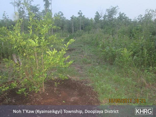
These photos were taken on May 18th 2017, in Kyainseikgyi Township, Dooplaya District. The photos show the land owned by villagers from P--- that was confiscated by the Tatmadaw Strategies Operations Command (SOC) based in Kyainseikgyi Town, Kyainseikgyi Township, Dooplaya District. The villagers had lime, lemon and rubber plantations on this land.
According to a KHRG community member, the Tatmadaw confiscated this land because it was situated on both sides of the road that goes to Q--- village, T’ka Hkee village and Kyainseikgyi Town. These photos show the rubber trees ready to be drained. Because this land was confiscated, villagers could not cultivate the rubber trees. They lost the opportunity to make an income from the rubber plantation that they depend on for their livelihoods. [Photos: KHRG]
This photo was taken on October 23rd 2017 in Nyein Chan Yay Myo Thit village, Kyar In village tract, Kyainseikgyi Township, Dooplaya District. It shows the area of the village where most of the families of BGF soldiers have settled down. To accommodate them, BGF battalions confiscated land owned by local villagers. A KHRG community member confirmed that Saw R--- is one of the villagers whose lands have been confiscated by BGF forces. [Photo: KHRG]
This photo was taken on October 23rd 2017 in P--- village, Kyainseikgyi Township, Dooplaya District. It shows a map that Saw R--- received when he received a land title from the KNU. His land was confiscated in 1997 by Major Hla Po. The land was subsequently transferred to the former Chairperson of Karen Peace Force Thuh Muh Heh. Presently, this land is being held by Thuh Muh Heh’s sons: Eh Htoo, who is a BGF Battalion Commander #1012, and Eh Mwee, a BGF Battalion Deputy Commander. According to Saw R---, Eh Htoo and Eh Mwee confiscated 173.8 acres of his land, and only returned few acres of his land back to him. [Photo: KHRG]
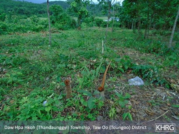
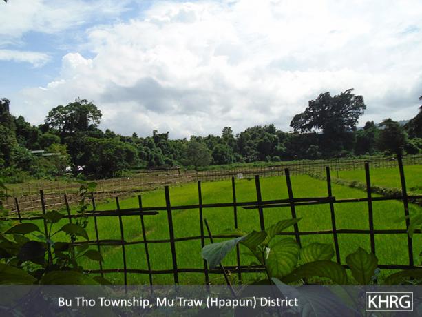
These photos were taken on July 26th 2017 in T--- village, Meh Klaw village tract, Bu Tho Township, Hpapun District. They show the lands traditionally owned by local villagers that have been confiscated by Tatmadaw Light Infantry Battalion (LIB) #340 from 1993 onwards. Today, the Tatmadaw LIB #340 rents these lands to villagers from U--- village, insisting that they pay rent. Because the Tatmadaw has confiscated large tracts of land in this area, community members find it difficult to secure their livelihoods. Even though villagers historically owned the land, and have tried to reclaim them after land confiscations, their voices were ignored by Tatmadaw. The Tatmadaw used intimidation tactics to confiscate these lands, and rent them back to local villagers. [Photos: KHRG]
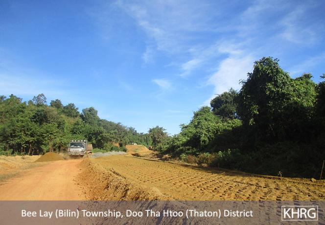
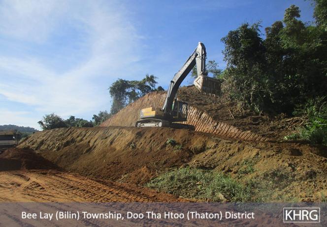
These photos were taken on November 30th 2017 in V--- village, Meh Naw Thaw village tract, Bilin Township, Thaton District. The photos show Mee Zaing Taung Company building a road. Bo Play, an Operations Commander of the Karen National Liberation Army in Thaton District, was in charge of contracting this road. The construction of this road has destroyed the lands and plantations of local community members. Despite the damage, community members have not received any compensation because of the terms set forward by Bo Play. They were told by Bo Play that no compensation would be provided for the destruction of land or property. Local community members are unhappy with this situation. They do not feel confident in their ability to oppose the negative impacts of this road construction. [Photos: KHRG]
Footnotes:
[2] This Photo Set was compiled by KHRG office staff and is based on information from a community member from Toungoo, Hpapun, Nyaunglebin and Dooplaya districts who has been trained by KHRG to monitor local human rights conditions. In order to increase the transparency of KHRG methodology and more directly communicate the experiences and perspectives of villagers in southeast Burma/Myanmar, KHRG aims to make all field information received available on the KHRG website once it has been processed and translated, subject only to security considerations. For additional reports categorised by Type, Issue, Location and Year, please see the Related Readings component following each report on KHRG’s website.

