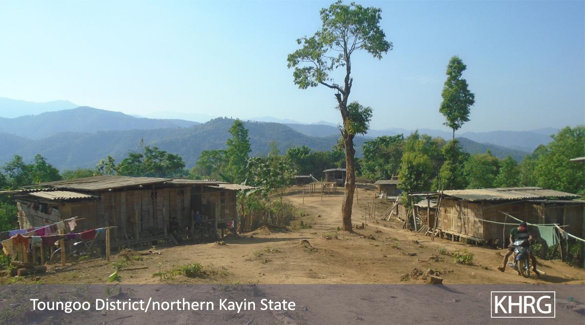
Tatmadaw forces continue to target civilian settlements and food supplies in upland areas of Toungoo District. On May 15th 2011 a joint patrol of LIBs #375 and #541 looted civilian property and burned down six field huts containing stores of paddy seed belonging to villagers in Ku Ler Der village, Tantabin Township. Residents of Ku Ler Der and five other villages in the area fled their homes before the patrol entered in the area and, as of May 20th, remained in hiding and actively monitoring whether Tatmadaw operations in the area would continue. The loss of food production inputs, and displacement away from agricultural projects, comes at a time when villagers in the affected communities, and throughout eastern Burma, are struggling to finish planting hill fields while anticipating food shortages in the coming year, after irregular weather damaged cash crop plantations and undercut harvests in 2010. This report is based on information submitted by two KHRG researchers in Toungoo District on May 20th 2011.
On May 15th 2011, a joint patrol of soldiers from Tatmadaw Light Infantry Battalions (LIBs) #375 and #541 entered the Ku Ler Der village area, Tantabin Township and burned down six hill field huts containing paddy seed belonging to Ku Ler Der villagers, according to local sources that spoke with two KHRG researchers in Toungoo District. Residents of Ku Ler Der and five other villages in the area fled in advance of the Tatmadaw patrol; a KHRG researcher familiar with the area estimated that the total population of these communities is at least 1,000 villagers.
The KHRG researchers reported that LIBs #376 and LIB #541 are part of Tatmadaw Military Operation Command (MOC)[1] #9, which deployed to Toungoo District in January 2011.[2] According to local sources that spoke with the researchers, these battalions had rotated into the Tatmadaw camp at Naw Soh just two or three days prior to the May 15th attack. Naw Soh is located on the Kler Lah to Buh Hsa Kee vehicle road and approximately two hours on foot from Ku Ler Der village.
Villagers from the Ku Ler Der area told KHRG's researchers that they fled into hiding when a clash occurred outside the village between a Karen National Liberation Army (KNLA) force and the Tatamdaw patrol. Residents of five other villages in the vicinity of Ku Ler Der also fled, including: Khaw Dtu Poe, Law Bee Ler, Mee Daw Koh, Maw Thay Der, and Bper Loh villages. All of these communities are located in the eastern part of Gkaw Thay Der village tract,[3] between the Yaw Loh Gkloh River and the Kler Lah to Buh Hsa Kee vehicle road.
According to the KHRG researcher familiar with this area, residents of these villages are actively hiding from Tatmadaw soldiers, and have fled Tatmadaw patrols and attacks on their villages multiple times since 1974 and 1975, when the Tatmadaw initiated a pya ley pya or "four cuts" campaign in Toungoo District for the first time,[4] and in particular during major Tatmadaw offensive activity in the area in 1992, 1996, 2006-2007,[5] and 2009. Prior to 2006, villagers in this area would return to their villages after Tatmadaw forces withdrew from the area and rebuild homes and other structures that had been destroyed. Since 2006, however, a number of villages have remained abandoned, and residents have built huts near their agricultural projects and stayed in individually isolated locations, due to the accessibility of the area to Tatmadaw patrols and the frequency of attacks. Ku Ler Der, for example, is directly accessible from Tatmadaw camps along the vehicle road, particularly Gkaw Thay Der and Naw Soh. KHRG's researcher explained that Ku Ler Der is the first community a patrol departing southwest along the road from Gkaw Thay Der would reach.
Upon entering the area around Ku Ler Der on May 15th, soldiers from LIBs #376 and #541 looted food and belongings from field huts, as well as chickens and ducks belonging to residents of the village. The soldiers then burned down six field huts containing paddy seed. The six huts that were destroyed belonged to Saw P---, 57; Saw H---, 50; Saw L---, 30; Saw K---, 55; Saw M---, 57; and Saw B---, 56.
This attack and the loss of stores of paddy grain has compounded the challenges to food production and food security faced by villagers in the Ku Ler Der area since 2010. KHRG's researchers explained that most villagers in Toungoo cultivate plantation crops such as cardamom, betelnut and durian for their livelihoods, in addition to farming hillside paddy fields mainly for household consumption.[6] Severe drought across eastern Burma in 2010, however, devastated many villagers' plantations;[7] even plants that did not die were unproductive and could not be harvested. Because newly-planted plantation crops can take up to seven years to become productive, villagers in Toungoo expect the 2010 drought to undercut their livelihoods and food security well beyond 2011.
In early 2011, villagers in the Ku Ler Der area had prepared to cultivate hill fields in order to produce some rice by late 2011, and thereby soften the impact of anticipated food shortages and loss of incomes due to the failed harvest and destruction of plantations in 2010. Early rain during the 2011 hot season, however, prevented villagers from burning their fields properly.[8] When LIBs #375 and #541 attacked on May 15th, some villagers still had yet to plant their fields, and the paddy seed that was stored in the six field huts now cannot be planted. Other villagers who fled the area told KHRG's researchers, meanwhile, that they fled before finishing planting, and left bags of paddy seed in their fields, poorly protected from the elements. These villagers expressed concern that continued rain during their displacement would cause the seeds to begin sprouting inside the bags, after which they could not be planted.[9]
When KHRG's researchers reported this information on May 20th, residents of the six villages that fled remained in hiding in the forest, although some adult villagers had returned to their fields and field huts to check on their agricultural projects, food stores, and possessions. The villagers did not know if LIBs #375 and 541 would remain at Naw Soh camp and continue conducting patrols in the area. KHRG's researchers noted that this was the first time since 2009 that two Tatmadaw battalions have conducted a joint patrol in southern Toungoo, and expressed concern that patrols and other offensive operations could increase in the coming weeks, further disrupting livelihoods and food production activities for local communities.
Footnotes:
[1] A Military Operations Command (MOC) typically consists of ten battalions. Most MOCs have three Tactical Operations Commands (TOCs), made up of three battalions each.
[2] See: "Toungoo Situation Update and Interviews: May 2010 to January 2011," KHRG, May 2011; "Toungoo Incident Reports: March and April 2011," KHRG, May 2011.
[3] Gkaw Thay Der village tract is also sometimes referred to by its Burmese name, Yay Tho Gyi.
[4] Pya ley pya was designed to cut armed opposition off from sources of "food, funds, intelligence and recruits" and, in practice, referred to an extensive scorched earth campaign widely credited with enabling the Tatmadaw to take control of much of the country beginning in the 1950s. See: Martin Smith. Burma: Insurgency and the Politics of Ethnicity, New York: St. Martin's Press, 1999, pp.258-262.
[5] Note that the Tatmadaw waged a coordinated multi-battalion offensive targeting civilians across Karen State's northern Nyaunglebin, Papun and Toungoo districts between 2005 and 2008. The years 2006 and 2007 are mentioned above because KHRG's researcher explained that attacks on villages in eastern Gkaw Thay Der tract were particularly bad during these years. For background on the 2005-2008 Offensive, see: Self-protection under strain: Targeting of civilians and local responses in northern Karen State, KHRG, August 2010, pp.15-21.
[6] The soil quality and terrain in much of Toungoo District supports only limited rice or paddy farming. For this reason, most households are dependent on income generated from various plantation crops, such as betelnut, betel leaf, cardamom, durian and dog fruit. The loss of a year's crop can have devastating consequences for villagers' long-term food-security; see "Attacks on cardamom plantations, detention and forced labour in Toungoo District," KHRG, May 2010.
[7] Irregular weather across eastern Burma in 2010 contributed to large-scale food insecurity for many communities in the region in 2011. See: "Thaton Situation Updates: May 2010 to January 2011," KHRG, May 2011; "Toungoo Situation Update and Interviews: May 2010 to January 2011," KHRG, May 2011; and Acute food shortages threatening 8,885 villagers in 118 villages across northern Papun District, KHRG, May 2011. Food shortages are particularly bad in Lu Thaw Township, Papun District, where the irregular weather in 2010 exacerbated long-standing pressure on land resources and food production due to protracted displacement of thousands of civilians seeking to avoid attacks by the Tatmadaw.
[8] A KHRG researcher experienced in hill field farming explained that after hill fields are cut, fallen trees and brush must be burned off before the field is planted; this both fertilises the soil, and kills off termites and other insects that attack paddy plants, as well as the seeds and buds of weeds and other small plants or trees that compete with young paddy plants and attract insects. A hill field that cannot be burned properly due to early rain, therefore, is less able to support healthy, productive paddy plants.
[9] Planting a hill field may take anywhere from two to five days, depending on the size of the field and the number of family members and neighbours available to help. During this process, farmers sometimes leave bags of paddy grain overnight in their hill fields on small elevated wooden platforms, covered with plastic sheeting.