
 ,
,  ,
,  ,
, 
The above photos show the downstream wall of the dam that is being constructed in Htee Ler Klay in the A’Nya Pyah area. [Photos: KHRG]
The following photos were taken by a villager in Mergui-Tavoy District who has been trained by KHRG to monitor human rights conditions. They are presented below, censored where necessary for security purposes.[1] The 49 photos below were received along with other information from Mergui-Tavoy District, including 375 other photos, and eight interviews.[2]
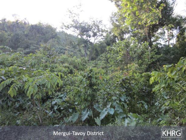
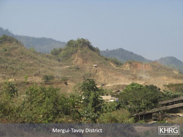
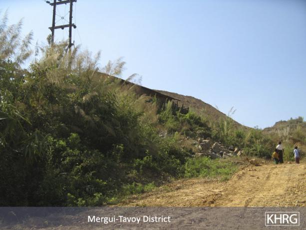
The photos below were taken on April 7th 2012 by a community member trained by KHRG in K'Ser Doh Township, Mergui-Tavoy District, and show different views of the A'Nya Pyah Dam construction site and surrounding area.
The photos below were taken on April 7th 2012 by a community member trained by KHRG in K'Ser Doh Township, Mergui-Tavoy District, and show different views of logging activities in A'Nya Pyah, U Yay Kyee and Htee Ler Klay villages.
The photos below were taken on January 11th 2012 by a community member trained by KHRG in K'Ser Doh Township, Mergui-Tavoy District and show different views of the Hkay Ta Mine site and surrounding area.
 ,
, 
The above photos show shelters on the upstream side of the dam site, where workers are housed. [Photos: KHRG]
The following photos were taken by a villager in Mergui-Tavoy District who has been trained by KHRG to monitor human rights conditions. They are presented below, censored where necessary for security purposes.[1] The 49 photos below were received along with other information from Mergui-Tavoy District, including 375 other photos, and eight interviews.[2]
The photos below were taken on April 7th 2012 by a community member trained by KHRG in K'Ser Doh Township, Mergui-Tavoy District, and show different views of the A'Nya Pyah Dam construction site and surrounding area.
The photos below were taken on April 7th 2012 by a community member trained by KHRG in K'Ser Doh Township, Mergui-Tavoy District, and show different views of logging activities in A'Nya Pyah, U Yay Kyee and Htee Ler Klay villages.
The photos below were taken on January 11th 2012 by a community member trained by KHRG in K'Ser Doh Township, Mergui-Tavoy District and show different views of the Hkay Ta Mine site and surrounding area.
 ,
, 
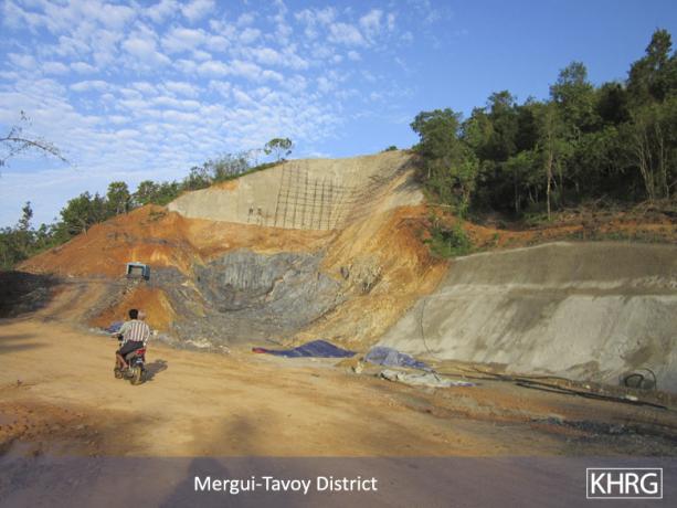
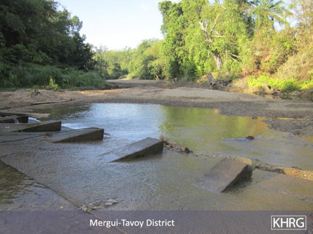
The above photos show the upstream wall of the dam, where the Htee Ler Klay and P'Ka Yee rivers will be diverted through the project site. [Photos: KHRG]
The following photos were taken by a villager in Mergui-Tavoy District who has been trained by KHRG to monitor human rights conditions. They are presented below, censored where necessary for security purposes.[1] The 49 photos below were received along with other information from Mergui-Tavoy District, including 375 other photos, and eight interviews.[2]
The photos below were taken on April 7th 2012 by a community member trained by KHRG in K'Ser Doh Township, Mergui-Tavoy District, and show different views of the A'Nya Pyah Dam construction site and surrounding area.
The photos below were taken on April 7th 2012 by a community member trained by KHRG in K'Ser Doh Township, Mergui-Tavoy District, and show different views of logging activities in A'Nya Pyah, U Yay Kyee and Htee Ler Klay villages.
The photos below were taken on January 11th 2012 by a community member trained by KHRG in K'Ser Doh Township, Mergui-Tavoy District and show different views of the Hkay Ta Mine site and surrounding area.
 ,
,  ,
,  ,
,  ,
,  ,
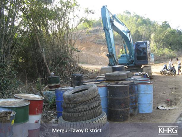
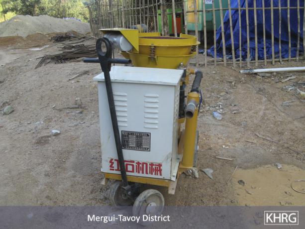
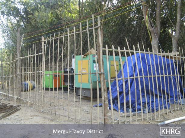
, 
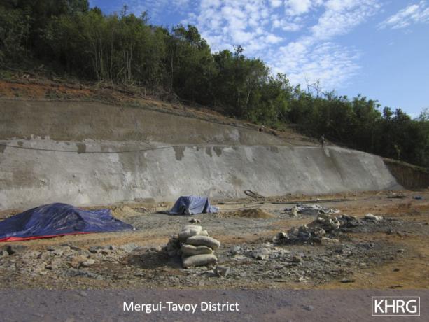
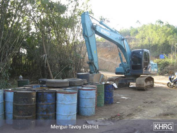
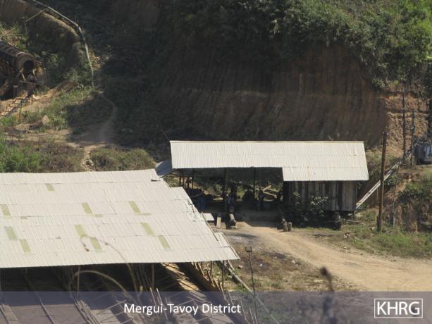
The above photos were taken in Htee Ler Klay village and depict equipment, stored chemicals, structures and graded landscape around the dam project site. [Photos: KHRG]
The following photos were taken by a villager in Mergui-Tavoy District who has been trained by KHRG to monitor human rights conditions. They are presented below, censored where necessary for security purposes.[1] The 49 photos below were received along with other information from Mergui-Tavoy District, including 375 other photos, and eight interviews.[2]
The photos below were taken on April 7th 2012 by a community member trained by KHRG in K'Ser Doh Township, Mergui-Tavoy District, and show different views of the A'Nya Pyah Dam construction site and surrounding area.
The photos below were taken on April 7th 2012 by a community member trained by KHRG in K'Ser Doh Township, Mergui-Tavoy District, and show different views of logging activities in A'Nya Pyah, U Yay Kyee and Htee Ler Klay villages.
The photos below were taken on January 11th 2012 by a community member trained by KHRG in K'Ser Doh Township, Mergui-Tavoy District and show different views of the Hkay Ta Mine site and surrounding area.
 ,
,  ,
,  ,
,  ,
,  ,
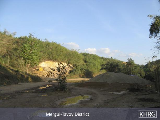
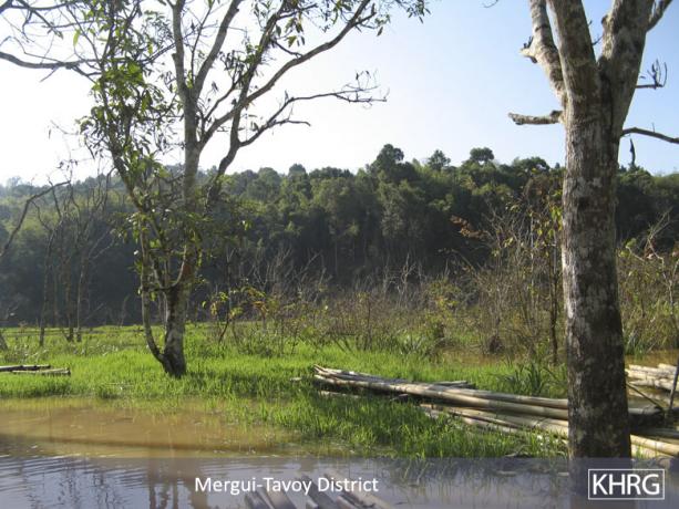
, 
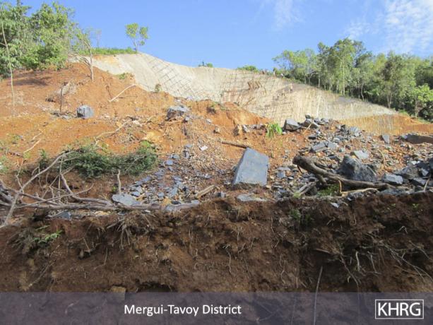
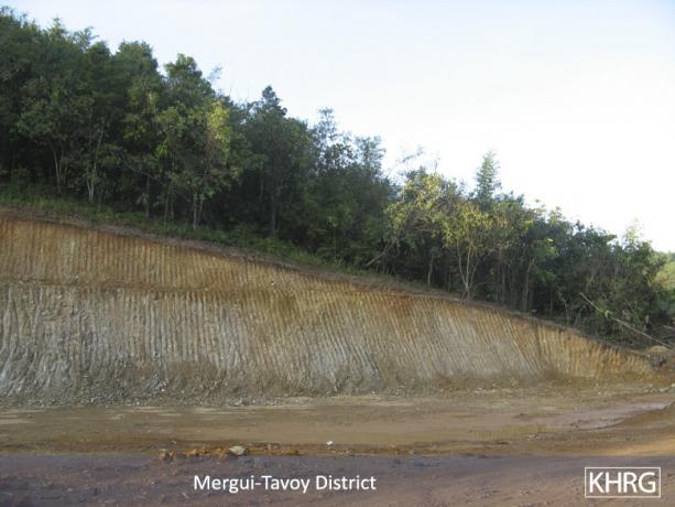
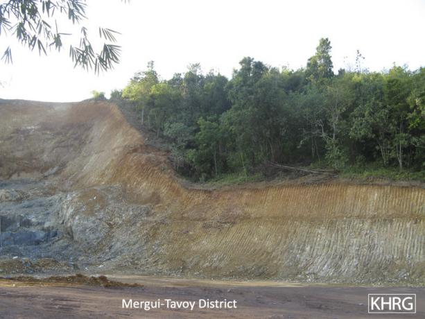
The above photos were taken in Htee Ler Klay village and show changes to the local landscape from the dam project. The top four photos show how the hillside has been dug out to widen the channel for water to flow, but the bottom two demonstrate that the project site itself is above much of the surrounding area. That land will flood when the dam is completed, which will destroy land where local people in Htee Ler Klay work for their livelihood. [Photos: KHRG]
The following photos were taken by a villager in Mergui-Tavoy District who has been trained by KHRG to monitor human rights conditions. They are presented below, censored where necessary for security purposes.[1] The 49 photos below were received along with other information from Mergui-Tavoy District, including 375 other photos, and eight interviews.[2]
The photos below were taken on April 7th 2012 by a community member trained by KHRG in K'Ser Doh Township, Mergui-Tavoy District, and show different views of the A'Nya Pyah Dam construction site and surrounding area.
The photos below were taken on April 7th 2012 by a community member trained by KHRG in K'Ser Doh Township, Mergui-Tavoy District, and show different views of logging activities in A'Nya Pyah, U Yay Kyee and Htee Ler Klay villages.
The photos below were taken on January 11th 2012 by a community member trained by KHRG in K'Ser Doh Township, Mergui-Tavoy District and show different views of the Hkay Ta Mine site and surrounding area.
 ,
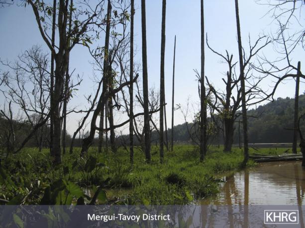
, 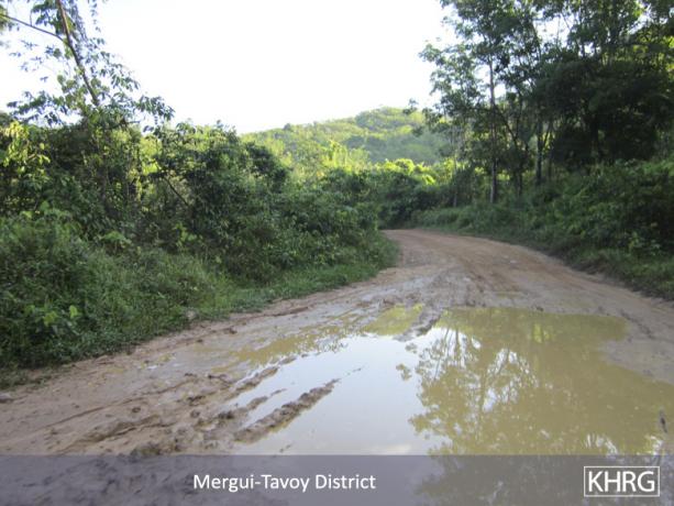
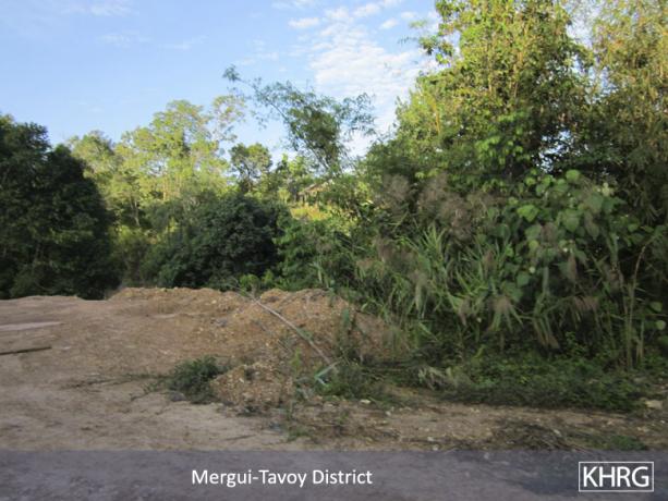
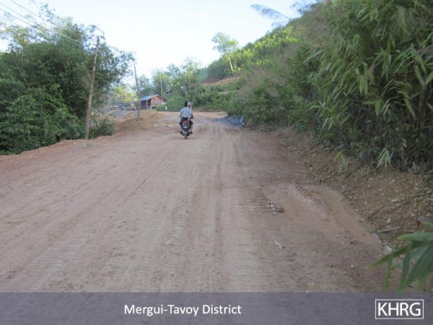
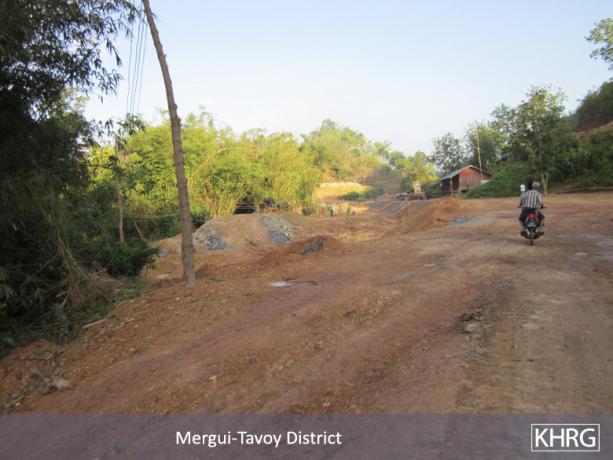
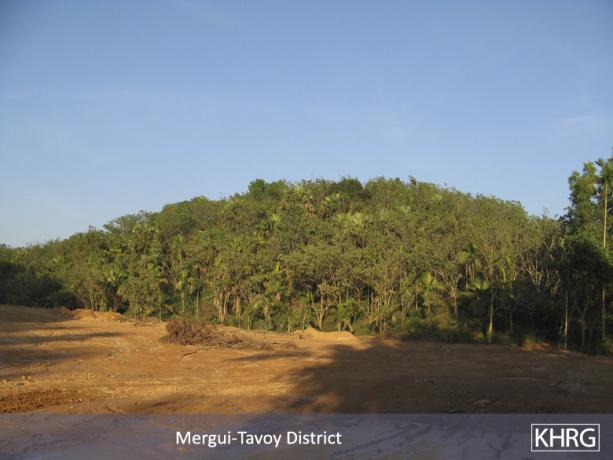
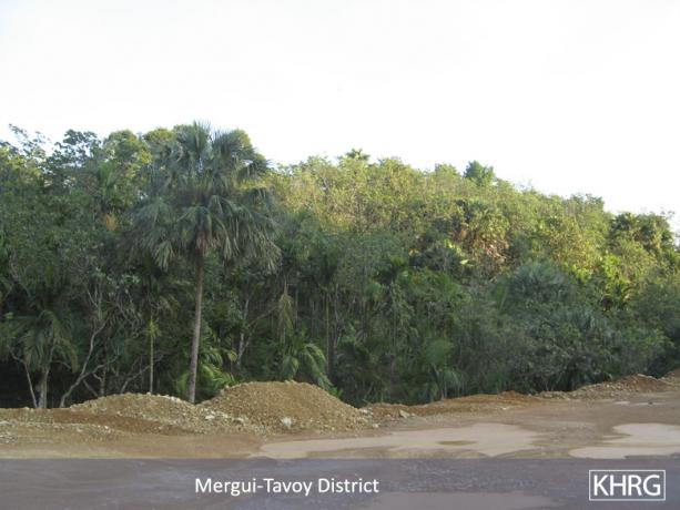
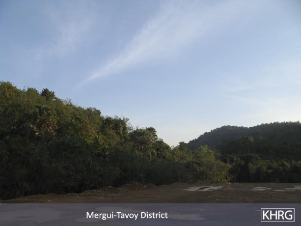
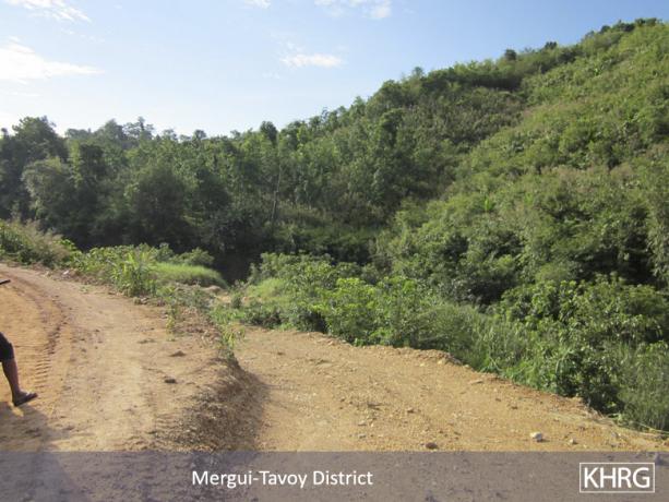
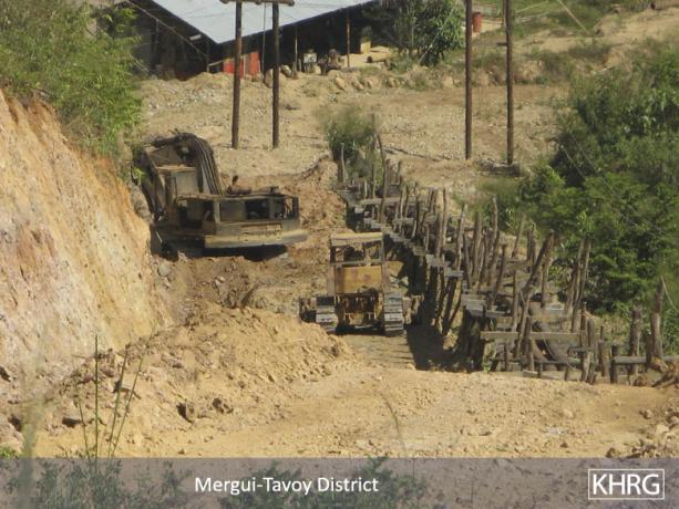
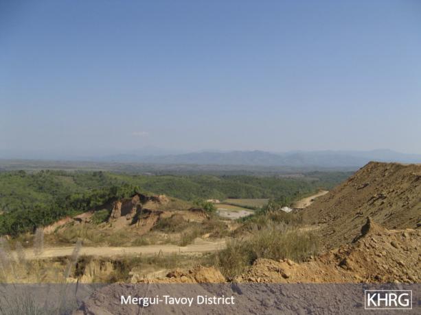
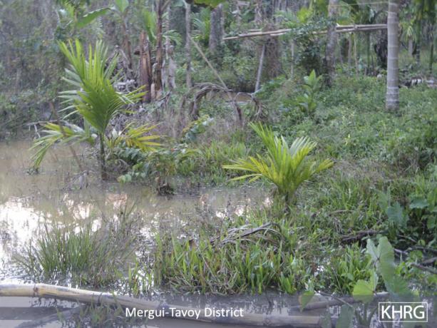
The above photos show a road and the landscape of the area where water for the dam will be diverted through. [Photos: KHRG]
The following photos were taken by a villager in Mergui-Tavoy District who has been trained by KHRG to monitor human rights conditions. They are presented below, censored where necessary for security purposes.[1] The 49 photos below were received along with other information from Mergui-Tavoy District, including 375 other photos, and eight interviews.[2]
The photos below were taken on April 7th 2012 by a community member trained by KHRG in K'Ser Doh Township, Mergui-Tavoy District, and show different views of the A'Nya Pyah Dam construction site and surrounding area.
The photos below were taken on April 7th 2012 by a community member trained by KHRG in K'Ser Doh Township, Mergui-Tavoy District, and show different views of logging activities in A'Nya Pyah, U Yay Kyee and Htee Ler Klay villages.
The photos below were taken on January 11th 2012 by a community member trained by KHRG in K'Ser Doh Township, Mergui-Tavoy District and show different views of the Hkay Ta Mine site and surrounding area.
 ,
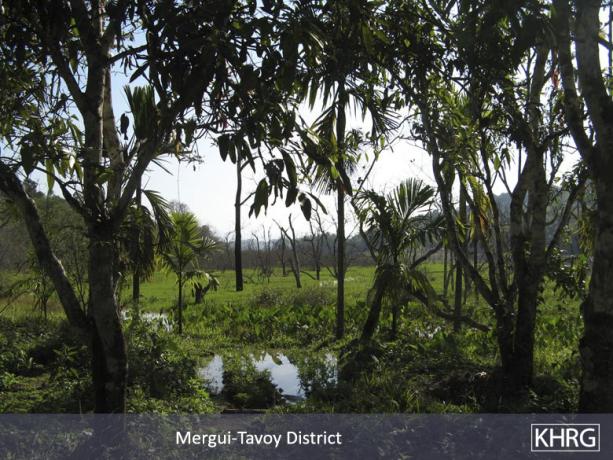
, 
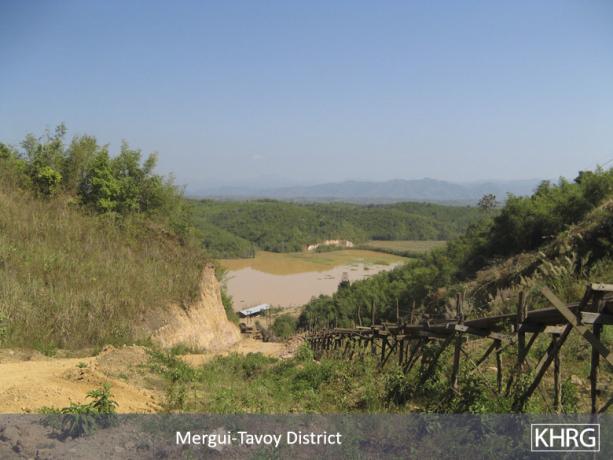
The photo on the left is of the Htee Ler Klay River and the photo on the right is of the P'Ka Yee River, both of which are above the dam and will flow into the reservoir for the dam. [Photos: KHRG]
The following photos were taken by a villager in Mergui-Tavoy District who has been trained by KHRG to monitor human rights conditions. They are presented below, censored where necessary for security purposes.[1] The 49 photos below were received along with other information from Mergui-Tavoy District, including 375 other photos, and eight interviews.[2]
The photos below were taken on April 7th 2012 by a community member trained by KHRG in K'Ser Doh Township, Mergui-Tavoy District, and show different views of the A'Nya Pyah Dam construction site and surrounding area.
The photos below were taken on April 7th 2012 by a community member trained by KHRG in K'Ser Doh Township, Mergui-Tavoy District, and show different views of logging activities in A'Nya Pyah, U Yay Kyee and Htee Ler Klay villages.
The photos below were taken on January 11th 2012 by a community member trained by KHRG in K'Ser Doh Township, Mergui-Tavoy District and show different views of the Hkay Ta Mine site and surrounding area.
 ,
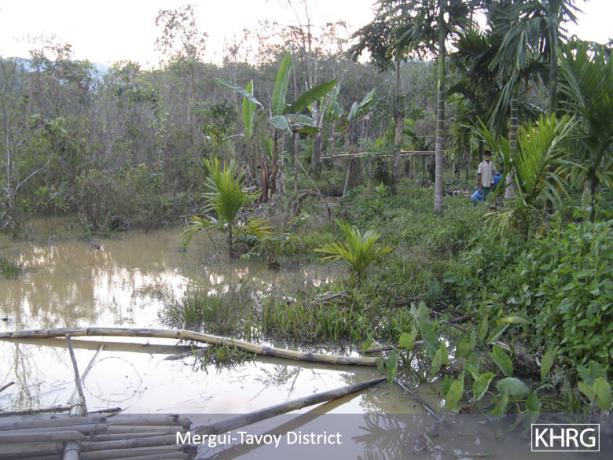
, 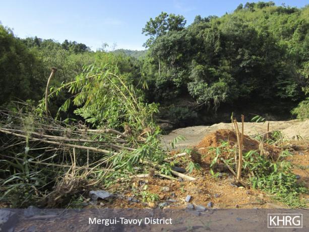
The photos show the side of the river opposite from the construction site. [Photos: KHRG]
The following photos were taken by a villager in Mergui-Tavoy District who has been trained by KHRG to monitor human rights conditions. They are presented below, censored where necessary for security purposes.[1] The 49 photos below were received along with other information from Mergui-Tavoy District, including 375 other photos, and eight interviews.[2]
The photos below were taken on April 7th 2012 by a community member trained by KHRG in K'Ser Doh Township, Mergui-Tavoy District, and show different views of the A'Nya Pyah Dam construction site and surrounding area.
The photos below were taken on April 7th 2012 by a community member trained by KHRG in K'Ser Doh Township, Mergui-Tavoy District, and show different views of logging activities in A'Nya Pyah, U Yay Kyee and Htee Ler Klay villages.
The photos below were taken on January 11th 2012 by a community member trained by KHRG in K'Ser Doh Township, Mergui-Tavoy District and show different views of the Hkay Ta Mine site and surrounding area.
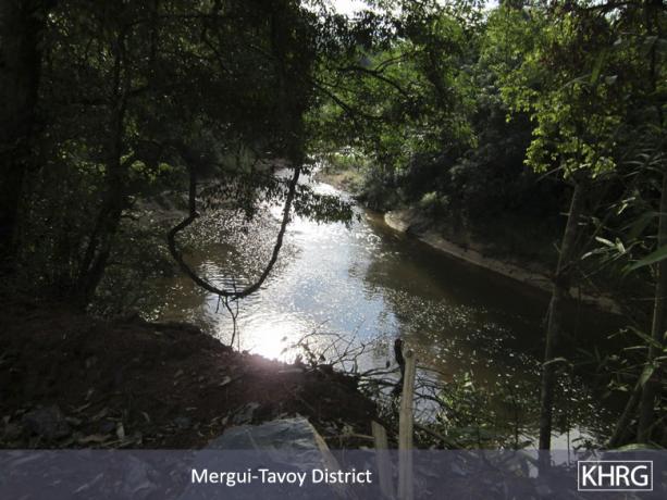
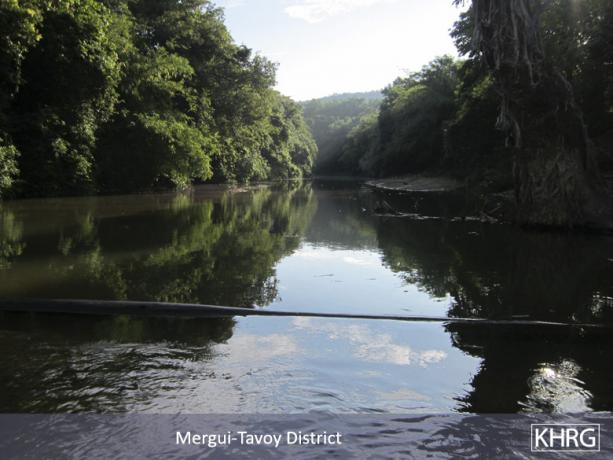
This photo shows the river that is the main water channel on which the dam will be built. [Photo: KHRG]
The following photos were taken by a villager in Mergui-Tavoy District who has been trained by KHRG to monitor human rights conditions. They are presented below, censored where necessary for security purposes.[1] The 49 photos below were received along with other information from Mergui-Tavoy District, including 375 other photos, and eight interviews.[2]
The photos below were taken on April 7th 2012 by a community member trained by KHRG in K'Ser Doh Township, Mergui-Tavoy District, and show different views of the A'Nya Pyah Dam construction site and surrounding area.
The photos below were taken on April 7th 2012 by a community member trained by KHRG in K'Ser Doh Township, Mergui-Tavoy District, and show different views of logging activities in A'Nya Pyah, U Yay Kyee and Htee Ler Klay villages.
The photos below were taken on January 11th 2012 by a community member trained by KHRG in K'Ser Doh Township, Mergui-Tavoy District and show different views of the Hkay Ta Mine site and surrounding area.
 ,
, 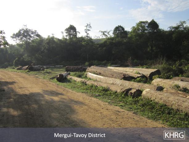
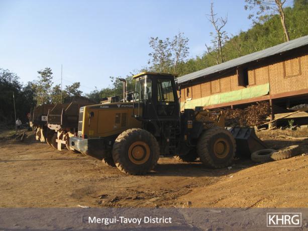
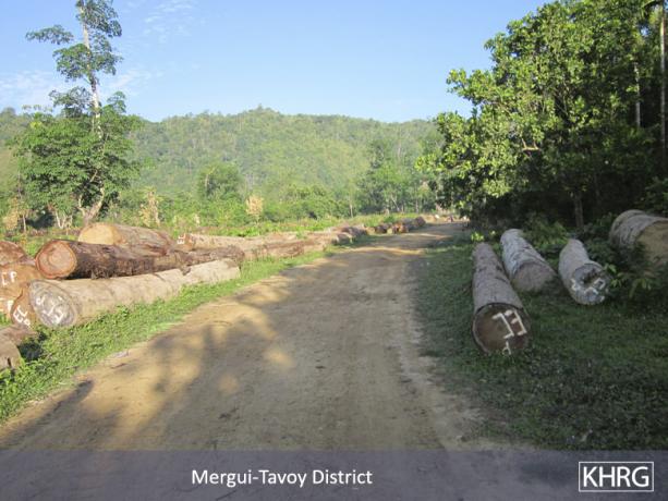
The above photos show logs that were cut down by the Burma Logging Company, and are being stored in U Yay Kyee village. [Photos: KHRG]
The following photos were taken by a villager in Mergui-Tavoy District who has been trained by KHRG to monitor human rights conditions. They are presented below, censored where necessary for security purposes.[1] The 49 photos below were received along with other information from Mergui-Tavoy District, including 375 other photos, and eight interviews.[2]
The photos below were taken on April 7th 2012 by a community member trained by KHRG in K'Ser Doh Township, Mergui-Tavoy District, and show different views of the A'Nya Pyah Dam construction site and surrounding area.
The photos below were taken on April 7th 2012 by a community member trained by KHRG in K'Ser Doh Township, Mergui-Tavoy District, and show different views of logging activities in A'Nya Pyah, U Yay Kyee and Htee Ler Klay villages.
The photos below were taken on January 11th 2012 by a community member trained by KHRG in K'Ser Doh Township, Mergui-Tavoy District and show different views of the Hkay Ta Mine site and surrounding area.
 ,
, 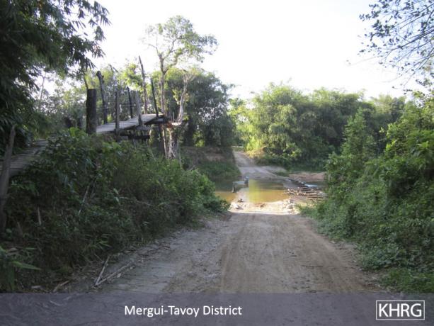
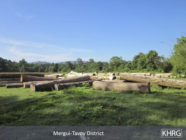
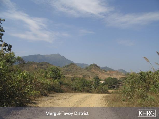
The photo on the leftshows additional logs that the Burma Logging Company stored between Htee Ler Klay and A'Nya Pyah villages. The photo on the right shows the vehicle road that links U Yay Kyee, Htee Ler Klay, A'Nya Pyah, Hsay Hklaw and Nyaw Hklaw villages. [Photos: KHRG]
The following photos were taken by a villager in Mergui-Tavoy District who has been trained by KHRG to monitor human rights conditions. They are presented below, censored where necessary for security purposes.[1] The 49 photos below were received along with other information from Mergui-Tavoy District, including 375 other photos, and eight interviews.[2]
The photos below were taken on April 7th 2012 by a community member trained by KHRG in K'Ser Doh Township, Mergui-Tavoy District, and show different views of the A'Nya Pyah Dam construction site and surrounding area.
The photos below were taken on April 7th 2012 by a community member trained by KHRG in K'Ser Doh Township, Mergui-Tavoy District, and show different views of logging activities in A'Nya Pyah, U Yay Kyee and Htee Ler Klay villages.
The photos below were taken on January 11th 2012 by a community member trained by KHRG in K'Ser Doh Township, Mergui-Tavoy District and show different views of the Hkay Ta Mine site and surrounding area.
 ,
,  ,
,  ,
,  ,
,  ,
,  ,
,  ,
,  ,
,  ,
, 
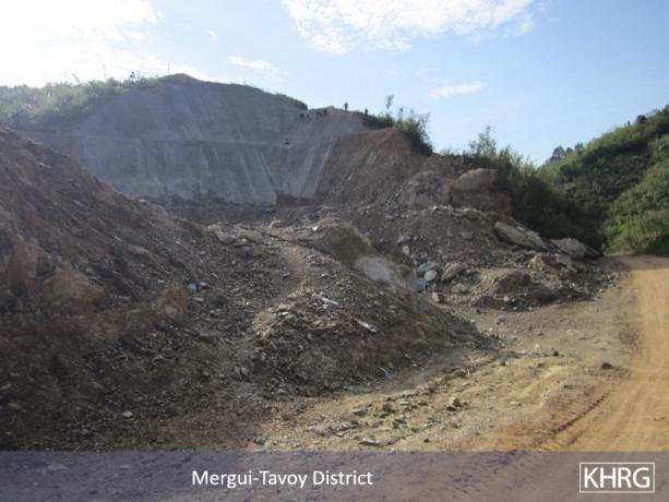
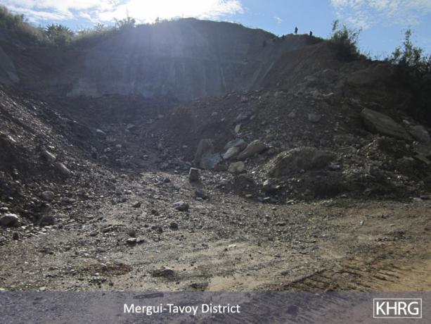
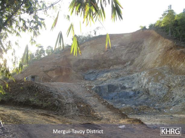
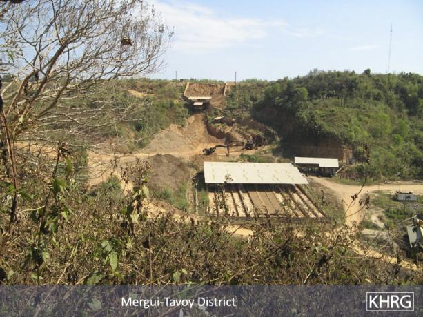
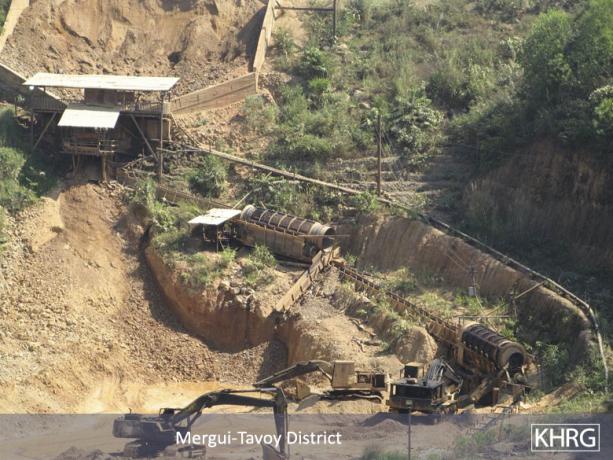
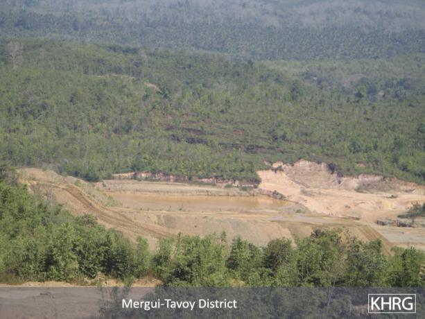
The top four photos above show different views of abandoned operations in Hkay Ta Mine, where metal was extracted from ore using an acid bath and other chemical agents. The bottom four photos show the area surrounding Hkay Ta Mine, in relation to the mountains. [Photos: KHRG]
The following photos were taken by a villager in Mergui-Tavoy District who has been trained by KHRG to monitor human rights conditions. They are presented below, censored where necessary for security purposes.[1] The 49 photos below were received along with other information from Mergui-Tavoy District, including 375 other photos, and eight interviews.[2]
The photos below were taken on April 7th 2012 by a community member trained by KHRG in K'Ser Doh Township, Mergui-Tavoy District, and show different views of the A'Nya Pyah Dam construction site and surrounding area.
The photos below were taken on April 7th 2012 by a community member trained by KHRG in K'Ser Doh Township, Mergui-Tavoy District, and show different views of logging activities in A'Nya Pyah, U Yay Kyee and Htee Ler Klay villages.
The photos below were taken on January 11th 2012 by a community member trained by KHRG in K'Ser Doh Township, Mergui-Tavoy District and show different views of the Hkay Ta Mine site and surrounding area.
 ,
, 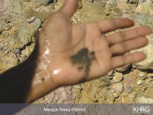
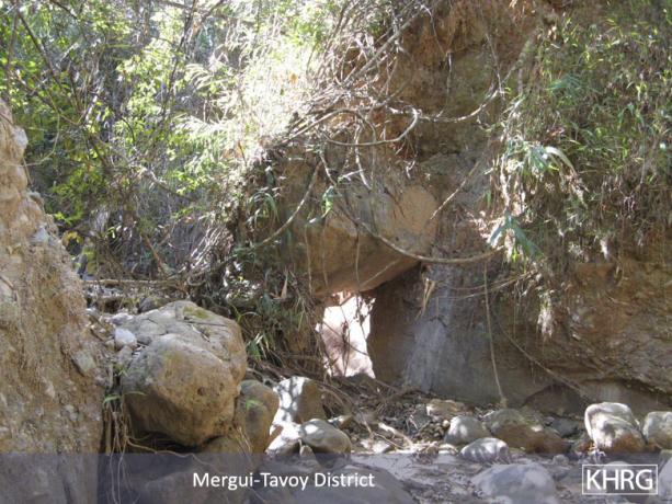
The above photos were taken in Hkay Too Hkee village. On the left, the stream in the photo is downstream from the Hkay Ta Mine and contains runoff from the mine, including chemicals used to extract metal from ore. Although the mining company no longer operates in this area, the company prevented villagers from accessing the stream in order to drain it so as to avoid the flow of chemicals. The photo on the right shows mining chemicals that the stream contains, on the community member's hand. [Photos: KHRG]
The following photos were taken by a villager in Mergui-Tavoy District who has been trained by KHRG to monitor human rights conditions. They are presented below, censored where necessary for security purposes.[1] The 49 photos below were received along with other information from Mergui-Tavoy District, including 375 other photos, and eight interviews.[2]
The photos below were taken on April 7th 2012 by a community member trained by KHRG in K'Ser Doh Township, Mergui-Tavoy District, and show different views of the A'Nya Pyah Dam construction site and surrounding area.
The photos below were taken on April 7th 2012 by a community member trained by KHRG in K'Ser Doh Township, Mergui-Tavoy District, and show different views of logging activities in A'Nya Pyah, U Yay Kyee and Htee Ler Klay villages.
The photos below were taken on January 11th 2012 by a community member trained by KHRG in K'Ser Doh Township, Mergui-Tavoy District and show different views of the Hkay Ta Mine site and surrounding area.
 ,
,  ,
,  ,
,  ,
,  ,
, 
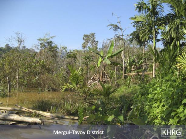
The above photos were taken in Hkay Too Hkee village, and show flooding of a villager’s betel nut plants and surrounding plantation land caused by a Thai mining company. [Photos: KHRG]
The following photos were taken by a villager in Mergui-Tavoy District who has been trained by KHRG to monitor human rights conditions. They are presented below, censored where necessary for security purposes.[1] The 49 photos below were received along with other information from Mergui-Tavoy District, including 375 other photos, and eight interviews.[2]
The photos below were taken on April 7th 2012 by a community member trained by KHRG in K'Ser Doh Township, Mergui-Tavoy District, and show different views of the A'Nya Pyah Dam construction site and surrounding area.
The photos below were taken on April 7th 2012 by a community member trained by KHRG in K'Ser Doh Township, Mergui-Tavoy District, and show different views of logging activities in A'Nya Pyah, U Yay Kyee and Htee Ler Klay villages.
The photos below were taken on January 11th 2012 by a community member trained by KHRG in K'Ser Doh Township, Mergui-Tavoy District and show different views of the Hkay Ta Mine site and surrounding area.