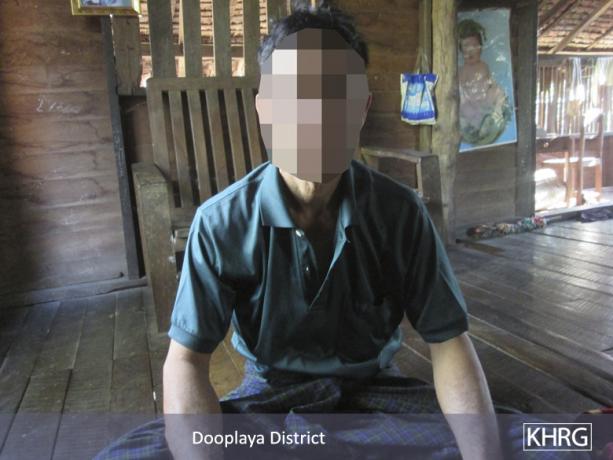
This Photo Set depicts road construction, including the Asian Highway, in Kyainseikgyi and Win Yay townships, Dooplaya District between November 2014 and January 2015. Villager testimony describes land confiscation and the destruction of houses, shops, and plantations in order to make way for the roads. Villagers also report a lack of compensation for the land and crops destroyed as a result of the road construction.
Photo Set | Kyainseikgyi and Win Yay townships, Dooplaya District (November 2014 to January 2015)
The following photos were taken by a community member in Dooplaya District who has been trained by KHRG to monitor local human rights conditions. They are presented below, censored where necessary for security purposes.[1] The ten photos below were received along with other information from Dooplaya District, including 450 other photos, eight video clips, two general updates on the situation in Dooplaya District and one incident report.[2]
The photos shown above were taken on December 31st 2014. The photo on the left shows 60-year-old Naw A--- who lives in B--- village, Win Yay Township, Dooplaya District and her plantation is shown in the picture on the right. Due to the construction of the Asian Highway,[3] her betel nut, coconut, mango, and jack fruit trees were destroyed. She said that she has not received any compensation for what she has lost. [Photos: KHRG]
The photo on the left was taken on January 22nd 2015 in Win Yay Township, Dooplaya District. It shows where the Asian Highway is being extended in order to straighten the road. Those with shops on this land knew nothing about the road being extended and so they did not move their shops and stayed on the land. The shop owners said the road construction company workers are slowly but surely pushing the soil into the area where the shops are. The villagers said that they will not move unless they receive compensation. The photo on the right was taken on November 30th 2014 in Kyainseikgyi Township, Dooplaya District. The name of this area is Lay Kee, located between C--- and D--- villages. On November 20th 2014, the road which goes from Kyainseikgyi Town to Kyaikdon Town had maintenance work begin on it by the Khin Zaw Company. Even though this was done to improve the road it destroyed parts of the surrounding land. The coconut tree in the photo will be destroyed as it is on the path and many betel nut trees have already been destroyed. The land owner has not yet received any compensation. [Photos: KHRG]
The above photos were taken on January 22nd 2015 in F--- village, A’Nan Kwin village tract, Win Yay Township, Dooplaya District. The photo on the left shows Saw E---’s wife who lost her house and land due to the construction of the Asian Highway. The photo on shows Saw G--- who also lost his house and the land his shop was on due to the construction of the Asian Highway. [Photos: KHRG]
The first two photos were taken on January 23rd 2015 in Win Yay Township, Dooplaya District. These photos show villagers repairing the road which connects H--- village to I--- village by themselves. The third photo was taken on November 30th 2014. The photo is from J--- village, between C--- and D--- villages, in Kyainseikgyi Township, Dooplaya District. The photo shows road construction by the Khin Zaw Company. It destroyed parts of a local sesame and rubber plantation. The plantation owner claimed that there should at least be compensation and if there is none, he will report the issue to the appropriate people. He is yet to receive any compensation. “This is harming [our] human rights,” was stated by the man that is standing in the third photo. The last photo was taken on February 7th 2015 in K--- village in Kyainseikgyi Township, Dooplaya District. In 2014 an unknown Chinese company came and built a clinic for the villagers but no one has utilised it yet. [Photos: KHRG]
Footnotes:
[1] KHRG trains community members in southeast Burma/Myanmar to document individual human rights abuses using a standardised reporting format; conduct interviews with other villagers; and write general updates on the situation in areas with which they are familiar.
[2] This Photo Set was compiled by KHRG office staff and is based on information from a community member from Dooplaya District who has been trained by KHRG to monitor local human rights conditions. In order to increase the transparency of KHRG methodology and more directly communicate the experiences and perspectives of villagers in southeast Burma/Myanmar, KHRG aims to make all field information received available on the KHRG website once it has been processed and translated, subject only to security considerations. For additional reports categorised by Type, Issue, Location and Year, please see the Related Readings component following each report on KHRG’s website.
[3] The Asian Highway Network is a United Nations Economic and Social Council for Asia and the Pacific-supported project that aims to link 32 countries in Asia across 141,000 kilometres of roadway. Kawkareik to Myawaddy is a route on the Asian Highway. In Burma/Myanmar the project has involved land confiscation and forced labour. For more information about the Asian Highway Network, see: “The Asia Highway: Planned Eindu to Kawkareik Town road construction threatens villagers’ livelihoods,” KHRG, March, 2015; “Hpa-an Situation Update: Paingkyon Township, July 2014,” KHRG, October 2014; “Tollgates upon tollgates: En route with extortion along the Asian Highway,” KHRG, October 2009; and “Development by Decree: The politics of poverty and control in Karen State,” KHRG, April 2007.


